Brighton Maps and Orientation
(Brighton and Hove, East Sussex, England, UK)
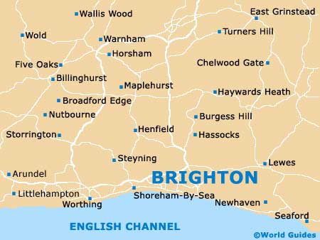
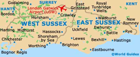
A leading seaside and tourist resort, Brighton is located within the county of East Sussex and on the southern shoreline of
England, between Worthing (west) and
Eastbourne (east). in 1997, Brighton merged with the neighbouring town of Hove and this city is now officially named 'Brighton and Hove'.
Old Steine is a prominent thoroughfare in Brighton and connects the pier with the city centre. On the western side you will find the pedestrianised streets generally referred to as 'The Lanes', where many popular eateries and shops reside. To the north, the North Laine area is especially bohemian in character and well worth searching out.
Maps and Orientation of the City
The gay scene in Brighton is well developed and is very much centred around the Kempton district, on James Street - directly east of the Old Steine. For maps and tourist information, the TIC is the place to come and is situated on Bartholomew Square. In particular, the 'Brighton Town Centre Map' comes highly recommended and is quite inexpensive.
Map of the United Kingdom

Map of Sussex
Map of Brighton